Dolly Vista Trail Camp (2532) to Cloudy Pass Junction (mile 2552, plus 6 miles to Hart Lake on the Holden Fire)
The scent of fire smoke wafts up from the valley floor rousing me from sleep. Outside the tent I can see small flares burning in the dark, the occasional tree igniting then burning a harsh orange so at odds with the blue night.

Later, when Starman’s alarm chimes time to hike we find that we are once again, perhaps forever and always, the last people in camp. Our plan to camp on this ridge in an effort to see how the fires are developing has proven moot. An ugly brown orange purple smoke blankets the hills and valleys below us, catching the first rays from the rising sun. There is no way for us to know what is happening, though somewhat comically the largest fire burning on Flower Dome is far enough from the trail that we need not worry about it. However, the small whisps of smoke that could be seen burning along Middle Ridge are right above the trail. Probably. But of course now we can’t tell, so it’s time to hike. Hike right down into the smokey mess.

During the nine mile descent towards the Suiattle River we discuss what we can or could or should do if the fire is too close to the trail. Our discussion turns round and round with no new information and no way to gain any more. If we need to bail we could take a side trail down to a remote campground where there might be cars who could take us the roughly 30 miles to highway 20, maybe. But then we’d be a days worth of hitching from our passports and resupply box. So that’s not good, but neither is walking towards an active forest fire. Maybe there will be a ranger at the bridge with information. But maybe they don’t no yet if nobody has reported this. But maybe. But maybe not. Around and around we go as the trail takes us down to the Suiattle River. It’s a maddening frustrating pattern of discussion with no way out except silence or a change of topic.
At the bridge there is no ranger, but there is a note from Road Runner and Autopilot saying they’ve got no new news. Well, that’s better than nothing but certainly less than ideal. Then, the thing we’ve all been waiting for happens! A southbounder! Then another! Both of whom respond “what fire?” And that’s going to have to be good enough. With smoke itching my throat we begin a 4,000 foot climb towards Cloudy Pass, never seeing or hearing the fire that we assume to be on the ridge we’re climbing. This is literally the best we could have hoped for, as the easiest way out is through.
I am tired, more from the hours of circular discussion and worry than from the climb. Having grown so accustomed to the era of instant Google information it feels bizzare to be thrust backwards to a time where I cannot learn things in an instant. As so many of these moments have done, this experience gives me great respect for those who hiked this trail 20 or even 50 years ago when the national scenic trail system was proposed.

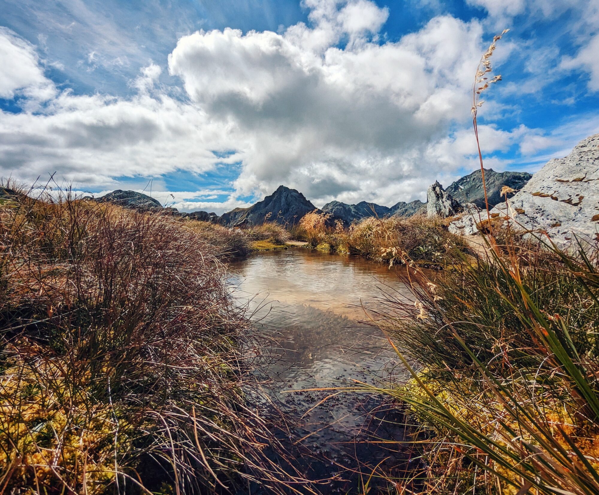
We crest Cloudy Pass via a convoluted and steep few miles. And as if Washington is looking to soothe us after a morning of stress, she puts on her best face for us. Mountains unlike any I have ever seen glow pink as the sinking sun shoots through the smoke overhead. Rivers drop thousands of feet in a series of fanning waterfalls to become turquoise lakes nestled in deep valleys. This section has been everything I wanted Washington to be, and inexpressibly more.

What are your plans for the beautiful photos ? These are treasures
I admittedly haven’t thought much about that. Maybe I’ll have to pull some of my favorites into a physical form.